Kate Retallick, from Bangor University, spoke about POLOMINTS on BBC Radio Wales on 4th June 2026.
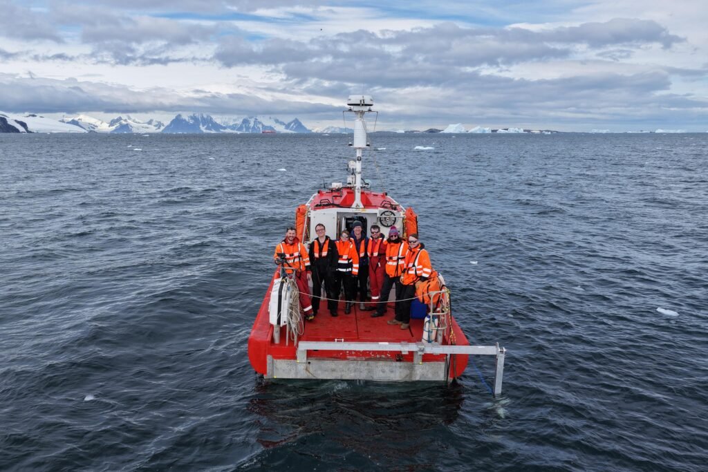
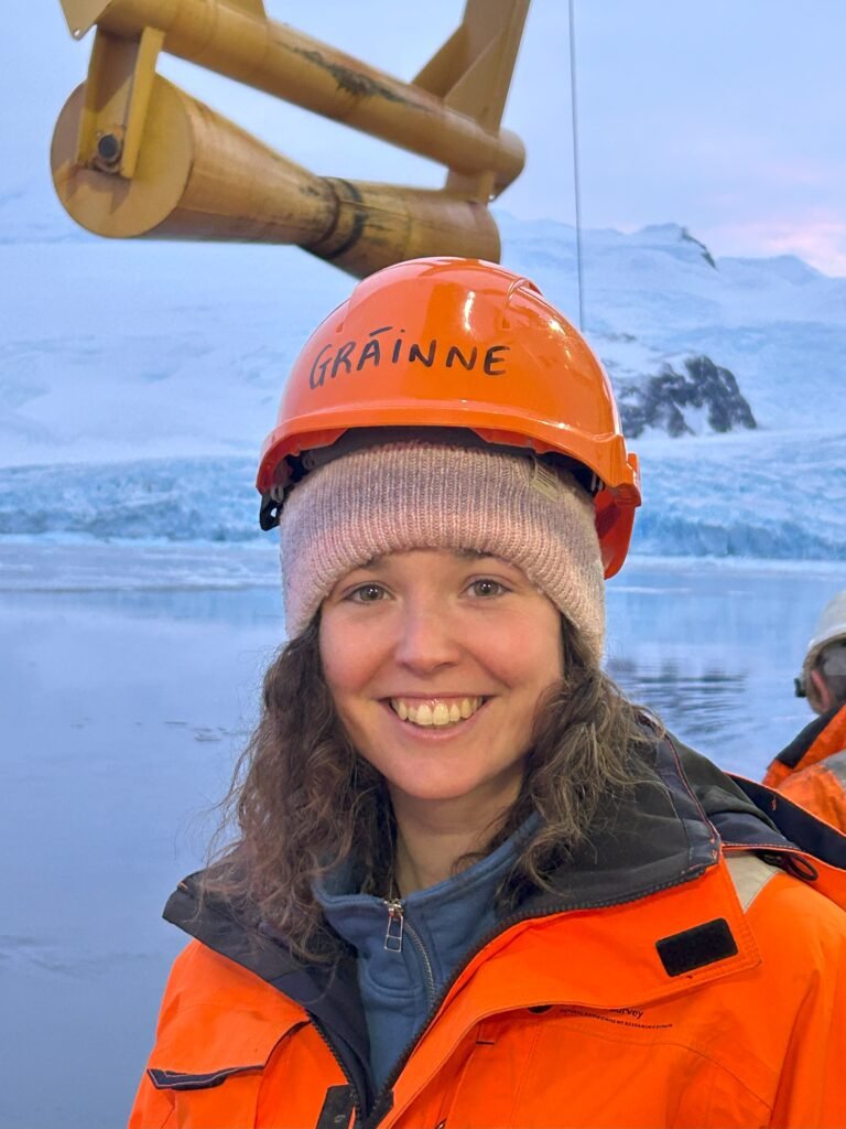
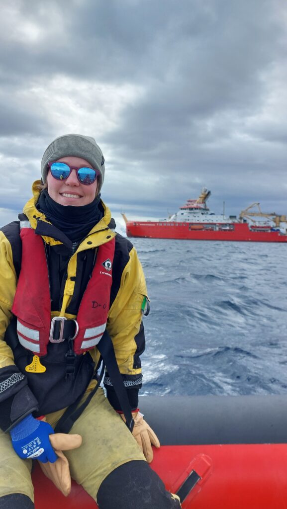
Kate and the rest of the crew on Erebus. (Credit: Kate Retallick)
In the segment (which can be found here, after the 1h55 mark) Kate talked about the POLOMINTS general research aims and how they used Bangor University’s multibeam echosounder mounted to Erebus to create the first 3D underwater profiles of the glacier margin in Sheldon Cove. She explained how this would be combined with oceanographic measurements and observations from stereo cameras to better assess the impacts of calving and generation of internal tsunamis in the fjord. Kate also spoke about the positive aspects of working in Antarctica, getting to continue the exploration of one of the remotest places on Earth, having been inspired to contribute in research there since childhood, plus amazing scenery and wildlife; and the not so good bits, i.e. having to spend a lot of time away from family.
Originally posted on the BAS websiteon 28th May 2026
British Antarctic Survey scientists and support staff are coming to the end of another successful Antarctic science season. As austral winter begins to set in, RRS Sir David Attenboroughhas completed a round of final calls to Rothera, King Edward Point and Bird Island Research Stations, leaving smaller wintering teams to continue research and operations.
The BAS field season (September 2025 to May 2026) saw 688 people working at various locations across the continent, including polar scientists, technicians and support staff. More than 50 science projects took place across land, ice and sea – covering topics from weather and climate to wildlife and ecosystems – as they worked to deepen our understanding of the polar regions and their wider impact on the planet.
“This season, our teams stepped up their work across Antarctica to understand this fragile system in transition. New methods were trialled, and field measurements were fused with autonomous technology, helping us to capture near-real time insight – from marine logistics to species management.”
Rothera Research Station
It’s been a season of change at Rothera Research Station on the Antarctic Peninsula. Older buildings have been removed, and the new Discovery Building is now fully operational, giving us a modern and more efficient hub for our polar science.
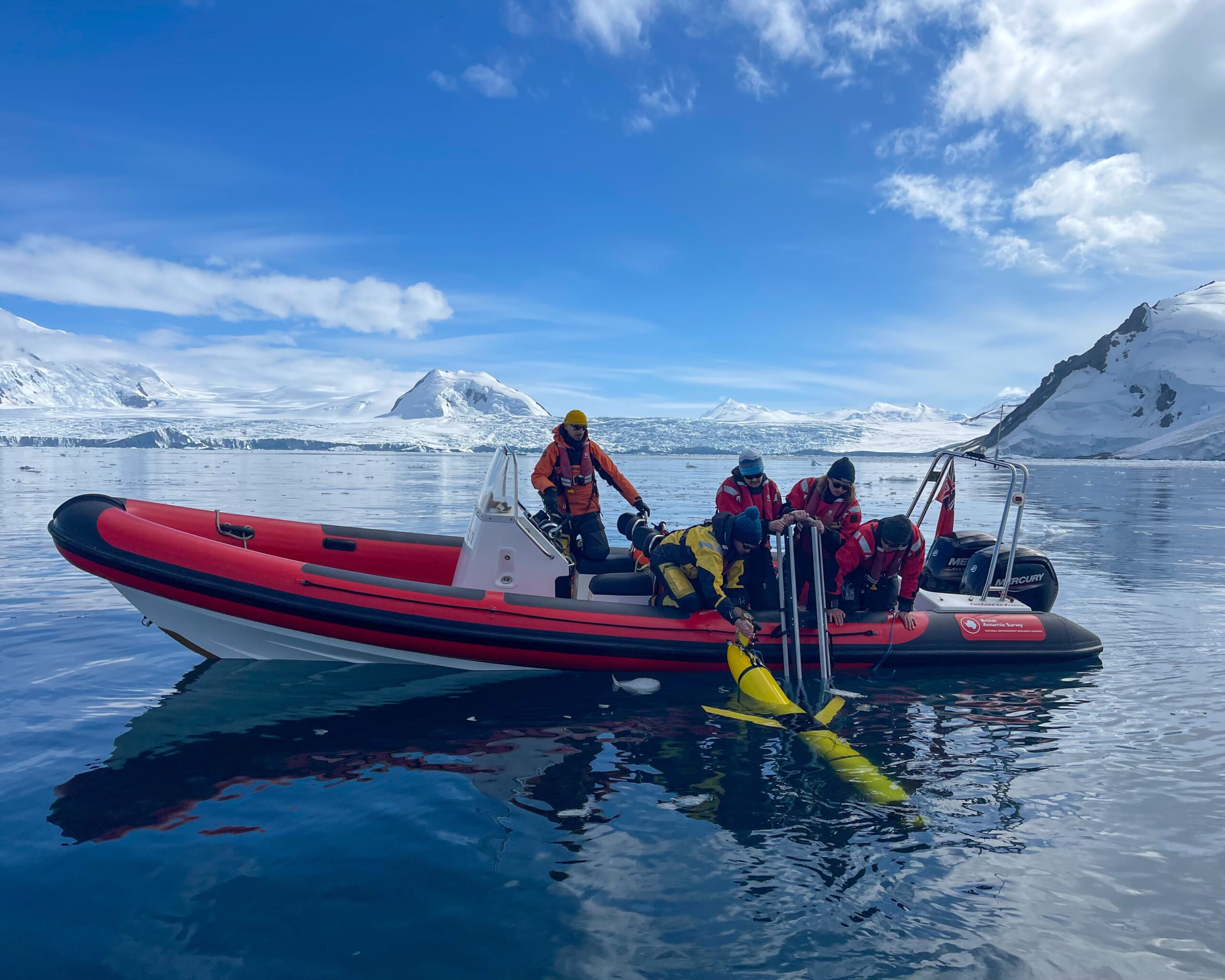
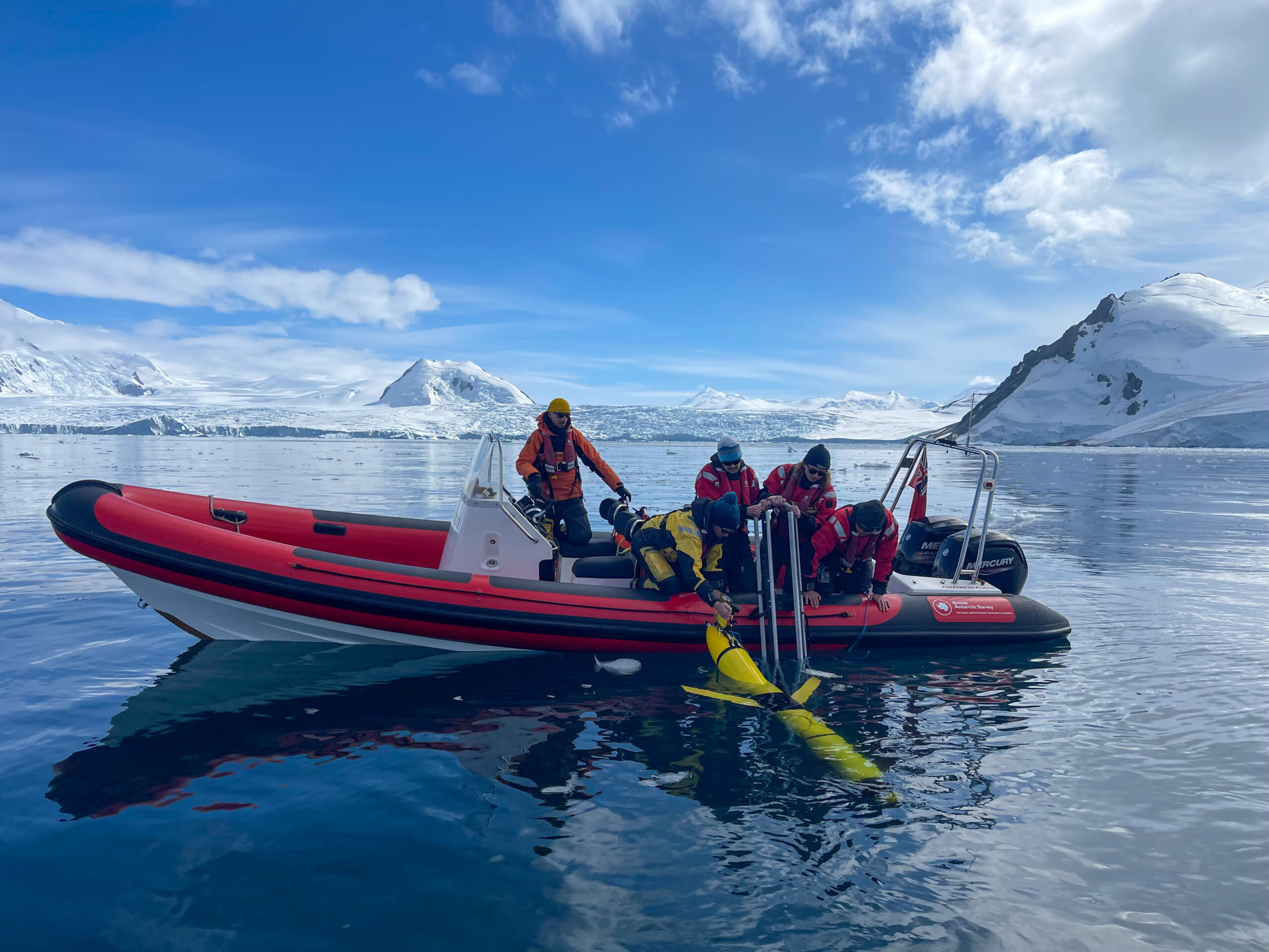
One of the major science projects was the NERC-funded POLOMINTS, operating out of Rothera to reach nearby Sheldon Glacier. Scientists studied underwater tsunamis caused by glaciers breaking off into the ocean, to see how this effects heat and nutrient cycling in the water. Using echo sounders and underwater gliders, they collected 3D images of glacier fronts and a wealth of other data to track changes above and below the water’s surface – helping to improve climate models.
The POLOMINTS team deploy an underwater glider at the Sheldon Glacier (Credit: Athena Dinar).
Long-term monitoring also continued at Rothera, expanding on a dataset running for over 25 years. Known as Rothera Time Series (RaTS), it involves water samples, ice observations, a monthly diving programme, and much more. The data acts as a baseline for the region, telling us what’s changed over recent decades and helping predict the impacts of a changing climate.
Halley VI Research Station
Meanwhile, at Halley VI Research Station on the floating Brunt Ice Shelf, the key focus was keeping the station operational for ongoing ice shelf, atmospheric, and space weather projects. It is home to equipment that gathers data autonomously for these projects year-round.
Addressing the challenges of this remote location were another key part of the season’s work. The team returned to Halley to find deep snow, and raised the whole station on its hydraulic legs twice during the season to avoid being buried. The team also navigated the exchange of cargo with the ice-capable cargo ship, the Silver Mary, from the Brunt’s ice cliff – an effort which represented the first year of our new shared logistics partnership with the Norwegian and German polar programmes.
Bird Island Research Station
Just off the northwest tip of South Georgia, scientists at Bird Island Research Station have been adding to their long-term monitoring dataset for marine predators. This includes population and breeding monitoring for species such as albatrosses, giant petrels, macaroni penguins, as well as Antarctic fur and leopard seals.
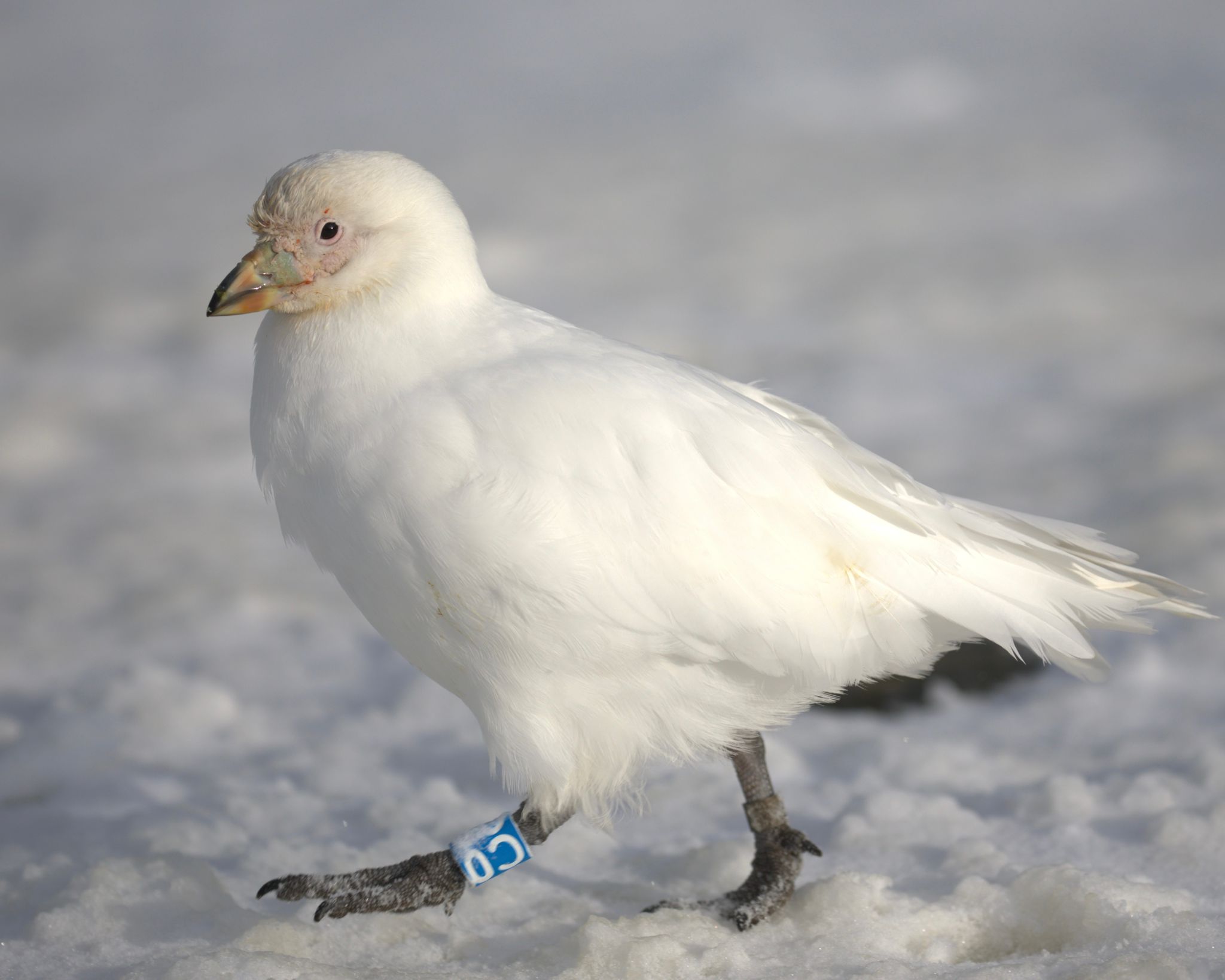
The species that has taken the spotlight this year is the snowy sheathbill – as little is known about their population size, migratory movements, or behaviours. Scientists on the island have now tagged over 400 of the birds. Re-sightings of these tags allow the scientists to build up a picture of how many sheathbills there are, and where they go. The birds are already revealing themselves to be willing travellers, with some tagged birds seen at other locations around South Georgia.
Snowy sheathbill with one of the scientific tags on its leg (Credit: Ashley Bennison).
King Edward Point Research Station
Further east on South Georgia lies King Edward Point (KEP) Research Station. The team at KEP have been monitoring populations of whales, seals, and penguins. This will help to guide management of fisheries and boating traffic to minimise their impact on wildlife. They’ve also gathered important data about avian influenza, including how it spreads between and impacts seals and seabird populations.
A highlight at KEP this season was the ECHO survey. This is a big project that aims to understand how wildlife interacts, and how environmental change can ripple through these wildlife populations. This is done by taking lots of ecosystem measurements at the same time, including acoustic surveys and net sampling for krill, plankton sampling, and observations of penguin, seal, and whale movements.
The Synchronised Swimming project formed a big part of this. Scientists attached GPS tags to penguins and used the GPS data in combination with the acoustic surveys to detect how the penguins interacted with krill swarms. Their data suggests the penguins are foraging in the same areas where the surveys detected krill, which is vital data to support the management of the marine protected area around the island.
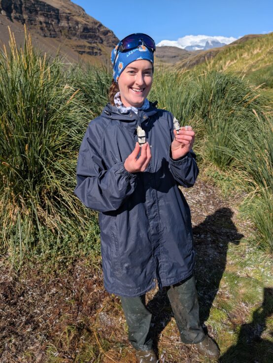
Camille De Pasquale holding two penguin-tagging devices in the field near King Edward Point Research Station (Credit: Jaimie Cleeland).
A mass washup of dead bivalves were also found on a beach close to KEP – with their shells a muted pink colour instead of their usual green. The team delivered a rapid science response, collecting samples to find out what happened, and what it indicates about the health of the Southern Ocean.
Signy Research Station
On the remote South Orkney Islands, science projects at Signy Research Station have involved monitoring marine predators, collecting bivalve samples, and investigating how the island’s vegetation is responding to a changing climate.
Scientists have also explored using a new state-of-the-art drone, which can take aerial surveys of the island while piloted by scientists in Cambridge in the UK. So far, the drone has created a useful 3D map of the island and conducted important surveys of wildlife populations. Scientists are hoping to use the drone in seasons to come to conduct surveys that wouldn’t have been possible before – such as monitoring early-nesting penguin species whose breeding begins before scientists return to the station in spring.
An aerial view of Signy Research Station from the DJI Dock I drone.
In the field
At a remote base camp 35km from Sky-Blu, the REWIND ice core drilling project aimed to collect samples from the last 10,000 years to see how winds and sea ice have influenced the uptake or release of carbon from the Southern Ocean. After digging out the previous season’s equipment, the team successfully drilled a 271-metre ice core, containing an estimated 1,000 years of climate data – the oldest ice core ever drilled in this part of the Antarctic Peninsula. Unfortunately, a broken drill part cut the work short. The data gathered will help us better predict whether the Southern Ocean is likely to absorb or release carbon in the future.
The ReWIND Team at the ice core drilling site near Sky Blu (Credit: Charlotte Phillips).
Scientists from BAS and the Korea Polar Research Institute (KOPRI) travelled to the unstable and rapidly-changing Thwaites Glacier in West Antarctica. The aim was to understand how ocean processes and seawater temperatures beneath the ice are driving melting, with potential for major sea level rise. BAS provided world-leading hot water drilling expertise, reaching over 1,000 metres through the ice to gather the first ever oceanographic data from beneath the glacier’s main trunk. This revealed turbulent and relatively warm waters melting the ice from below. However, plans to deploy instruments for long-term monitoring were foiled as the rapidly-moving glacier trapped the equipment within the ice. Regardless, the data gathered will be invaluable for understanding ocean-ice interactions at Thwaites.
The hot water drilling camp on top of Thwaites glacier (Credit: Peter Davis).
At Snow Hill on the Antarctic Peninsula, drone counts and tagging of emperor penguins supplemented wider monitoring of emperor penguin populations using satellite imagery. These data revealed dramatic sea ice changes and fewer groups of moulting emperor penguins. This has prompted the species to be classified as endangered by the IUCN Red List of Threatened Species.
At sea
It’s been a busy season on the polar research vessel, the RRS Sir David Attenborough (SDA). In December & January, the SDA was equipped with specialist sensors to assess the performance of its propellors and icebreaking capabilities in specific types of sea ice. It is hoped the results will enable future operations in conditions previously considered too challenging, and improve maritime safety in polar conditions.
Among the major science commitments of the season were the long-term monitoring of zooplankton and tracking of biogeochemical processes near South Georgia. This includes chemical sampling for important nutrients, krill sampling, and measurement of carbon flux, which will improve our understanding of ocean ecosystems and their role in climate regulation. These are some of the longest running polar marine datasets, which support the UK’s ‘national capability’ – they feed directly into area conservation plans and international policymaking forums like the international Commission for the Conservation of Antarctic Marine Living Resources (CCAMLR) within the Antarctic Treaty System.
The RRS Sir David Attenborough and the workboat, Terror, operating in the Southern Ocean (Credit: Joe Jackson).
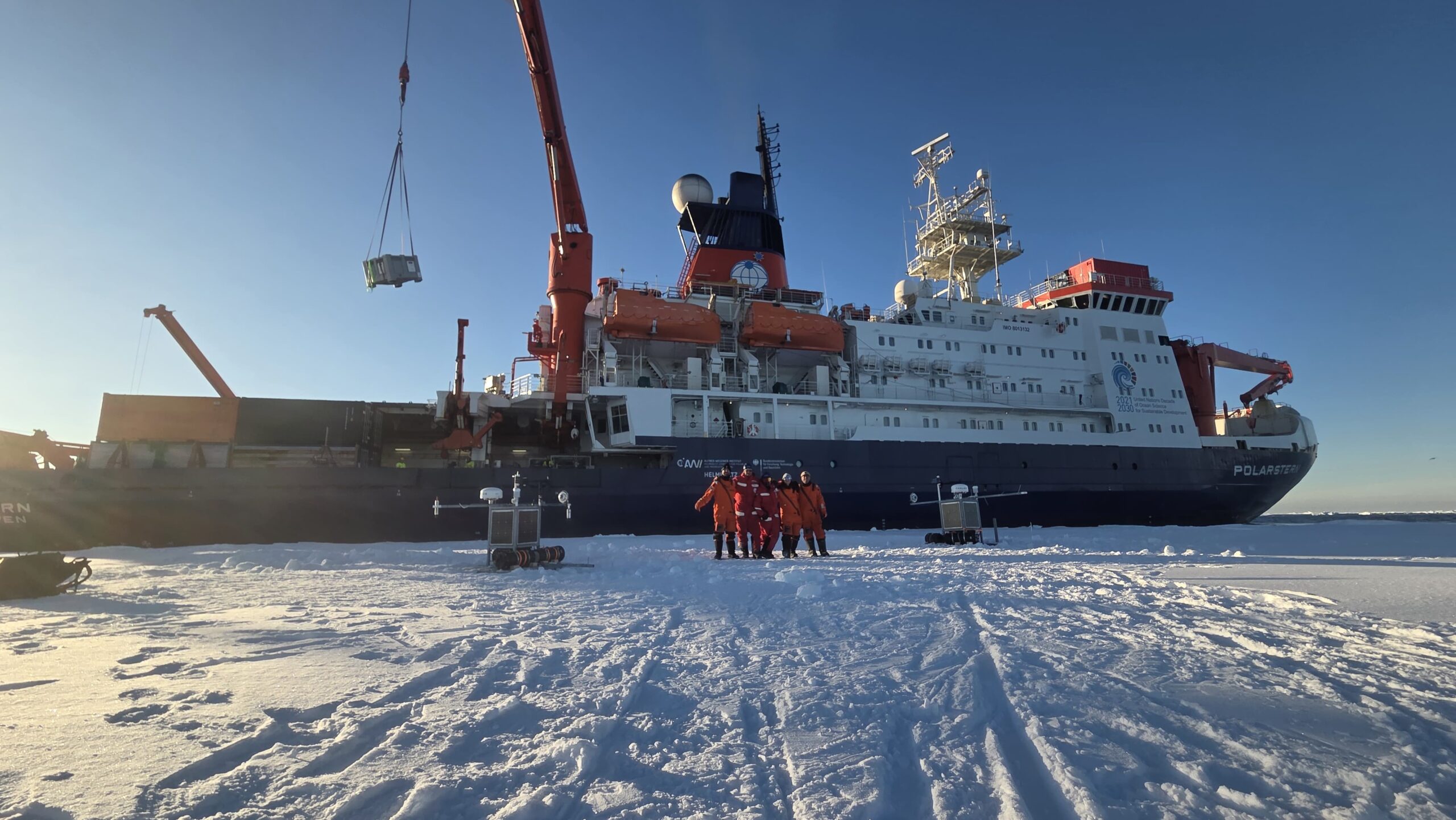
BAS scientists have also been busy in the Weddell Sea aboard multiple voyages on the German research ship, the RV Polarstern. With the help of autonomous sea ice buoys, autonomous submarines and specialized atmosphere and aerosol sensors, they took a range of measurements from sea ice properties, marine biodiversity and atmospheric composition. Despite rough seas and 41m/s winds, the team gathered some vital data – data that will be critical for understanding changing Antarctic sea ice, the marine biodiversity it supports, ocean-ice-atmosphere interactions and Southern Ocean cloud processes.
Scientists in front of the RV Polarstern (Credit: A Medic, Alfred Wegener Institute, The University of Rostock).
A season to celebrate
With staff now returning home, the work is far from over. Samples and data collected throughout the season will feed into research efforts around the world, deepening our understanding of polar science and its role in our changing climate.
“I’d like to offer a profound thank you to the dedicated teams who worked on the ice, at sea, and elsewhere across BAS,” says Petra. “The data you gathered this season will help decision-makers respond to the planet’s changing climate and ecosystems, and work towards a secure future for us all.”
As is tradition, staff across the whole of BAS are now gearing up to celebrate midwinter’s day when it arrives on 21 June – from those on the SDA and overwintering at stations, to staff at our Cambridge sites and elsewhere in the world. The Antarctic Research Trends Report 2025 recently acknowledged BAS as the most productive and highest impact single polar institute in the world: something that is certainly worth celebrating.
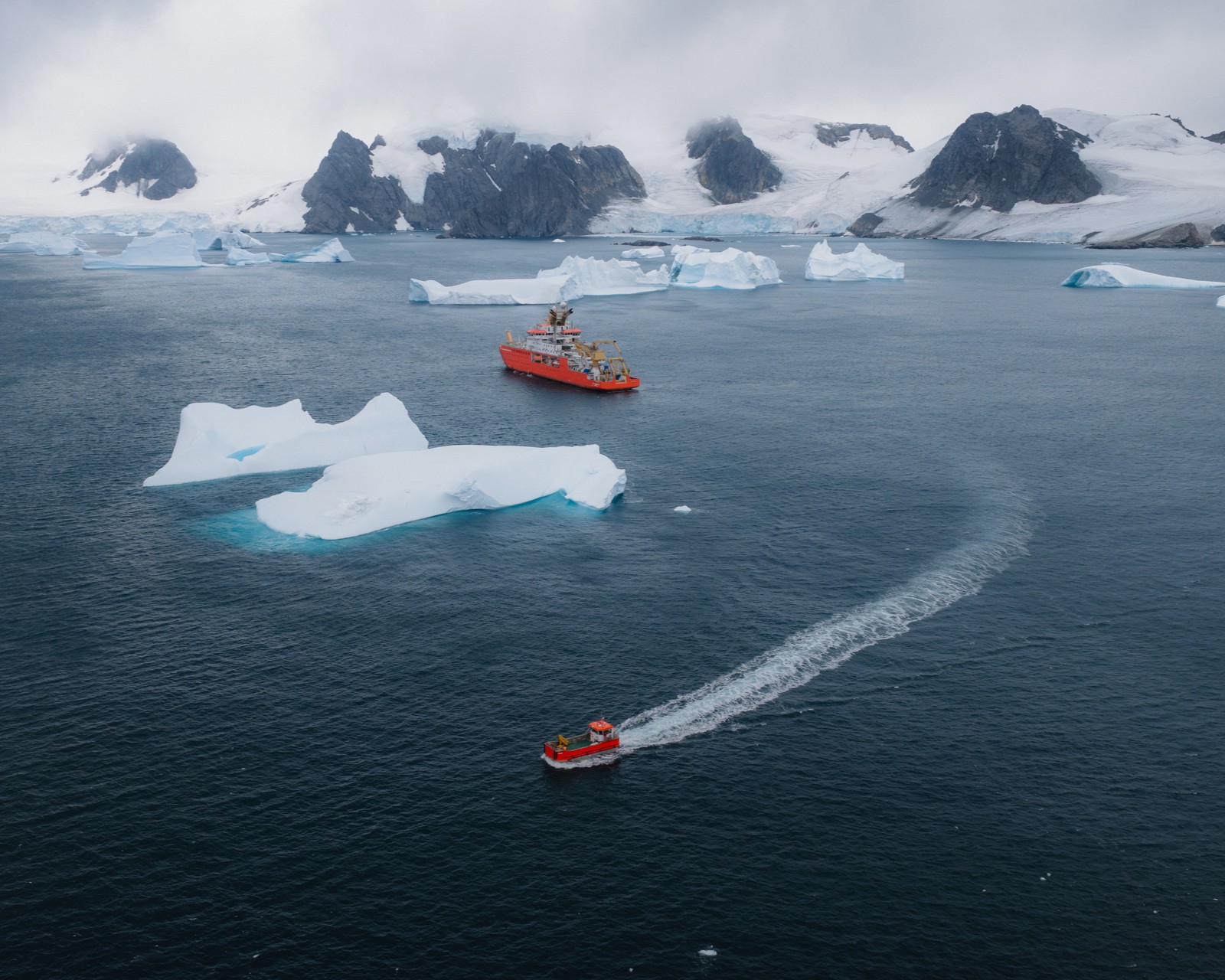
An international team of researchers, led by British Antarctic Survey (BAS), is setting out to discover how glacier calving around Antarctica can trigger powerful underwater tsunamis.
When icebergs break off glacier fronts and fall into the ocean (a process called calving) they can create powerful underwater tsunamis. These hidden waves, often several metres in height, cause powerful bursts of ocean mixing, where different layers of water get churned together. This process strongly mixes heat, oxygen and nutrients between different depths, and is critical for marine life and climate regulation in the region.
This mixing was previously thought to be primarily driven by wind, tides and heat loss at the ocean surface. However, initial calculations suggest underwater tsunamis play a significant role in polar oceans, rivalling the effect of wind-driven mixing in certain locations, and having a bigger impact than tides in redistributing heat in the ocean.
This newly discovered phenomenon was observed by chance when researchers aboard BAS’ previous research ship, RRS James Clark Ross, collected ocean data before, during and after a calving event during an expedition to Antarctica. Now, scientists are at Rothera Research Station, on the Antarctic Peninsula, and on board the UK’s polar research ship RRS Sir David Attenboroughto learn more about underwater tsunamis.
“We want to learn what creates underwater tsunamis, how they work, and what impact they have – do different types of calving cause differences in the tsunami? Do the different conditions in each season change how the tsunamis form? What does the mixing that they cause do to the polar climate and ecosystems?”
Using satellites, remote cameras, drones and underwater robots, the team will collect data from glacier fronts, including locations too dangerous for researchers to go. They will develop and apply deep-learning algorithms to analyse satellite data, and computer simulations to model how these tsunamis are generated and spread. From this, the researchers will assess the impacts of these intense bursts of mixing on ocean temperature, nutrients and marine productivity – all of which are critical to our climate and ecosystems.
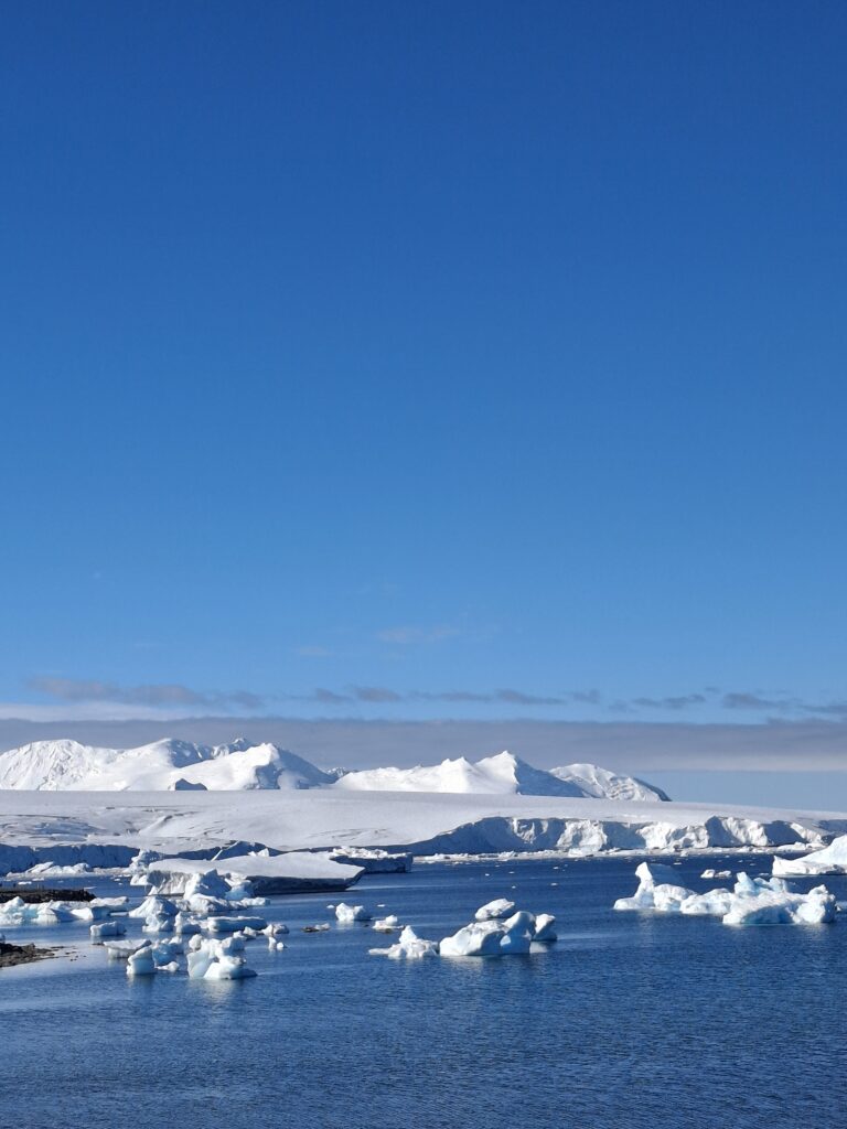
View over Sheldon Glacier. Credit: BAS
Dr Alexander Brearley is an oceanographer at BAS who studies ocean mixing. He is currently at Rothera Research Station using an autonomous underwater vehicle to study the front of the nearby Sheldon Glacier. He said:
“Our team is deploying a range of cutting-edge air, land-based and ocean technology to understand individual glacier calving events at unprecedented resolution and detail, and the impact the tsunamis that are generated have on the ocean. This includes high-quality imagery of the front of the glacier in real-time, ocean moorings with instruments to study the individual waves generated by calving, and underwater autonomous vehicles to document the physical and biological impacts of these underwater tsunamis.”
Underwater tsunamis, and the resulting mixing, could have significant implications for the Southern Ocean and beyond. Increased ocean mixing could draw more warm water up from the deeper parts of the ocean, speeding up the melting of the Antarctic Ice Sheet which would raise sea levels around the world. It can also change how nutrients are distributed in the ocean, which would affect the growth of phytoplankton (the “grass of the sea”), with consequences for the rest of the ocean food chain.
“Antarctica remains one of the most mysterious places on Earth, and we’re constantly discovering previously unknown processes that are shaping our planet. What makes this research so important is that everything in Antarctica is connected – ice, ocean and atmosphere – and those connections reach all the way back to our doorsteps. Rising sea levels, shifting weather patterns, these are Antarctic processes playing out in our lives.”
A key question going forward is understanding whether the current warming climate might increase how often these calving and tsunami events occur, and how strong they are. By learning more about this phenomenon, scientists will refine the ocean models that predict how climate will change in the future.
The POLOMINTS project is a collaboration led by British Antarctic Survey, and includes the Scottish Association for Marine Science, the University of Southampton, the University of Leeds, the National Oceanography Centre, the University of Exeter, and Bangor University. International partners are from the Scripps Institution of Oceanography (USA), the Institute of Geophysics of the Polish Academy of Sciences (Poland), the University of Delaware, and Tufts University (both USA).
POLOMINTS is funded by the Natural Environment Research Council (nerc.ac.uk)
Professor Mike Meredith is an oceanographer at British Antarctic Survey. He concludes a first of its kind science cruise on the RRS Sir David Attenborough conducting research in the polar winter.
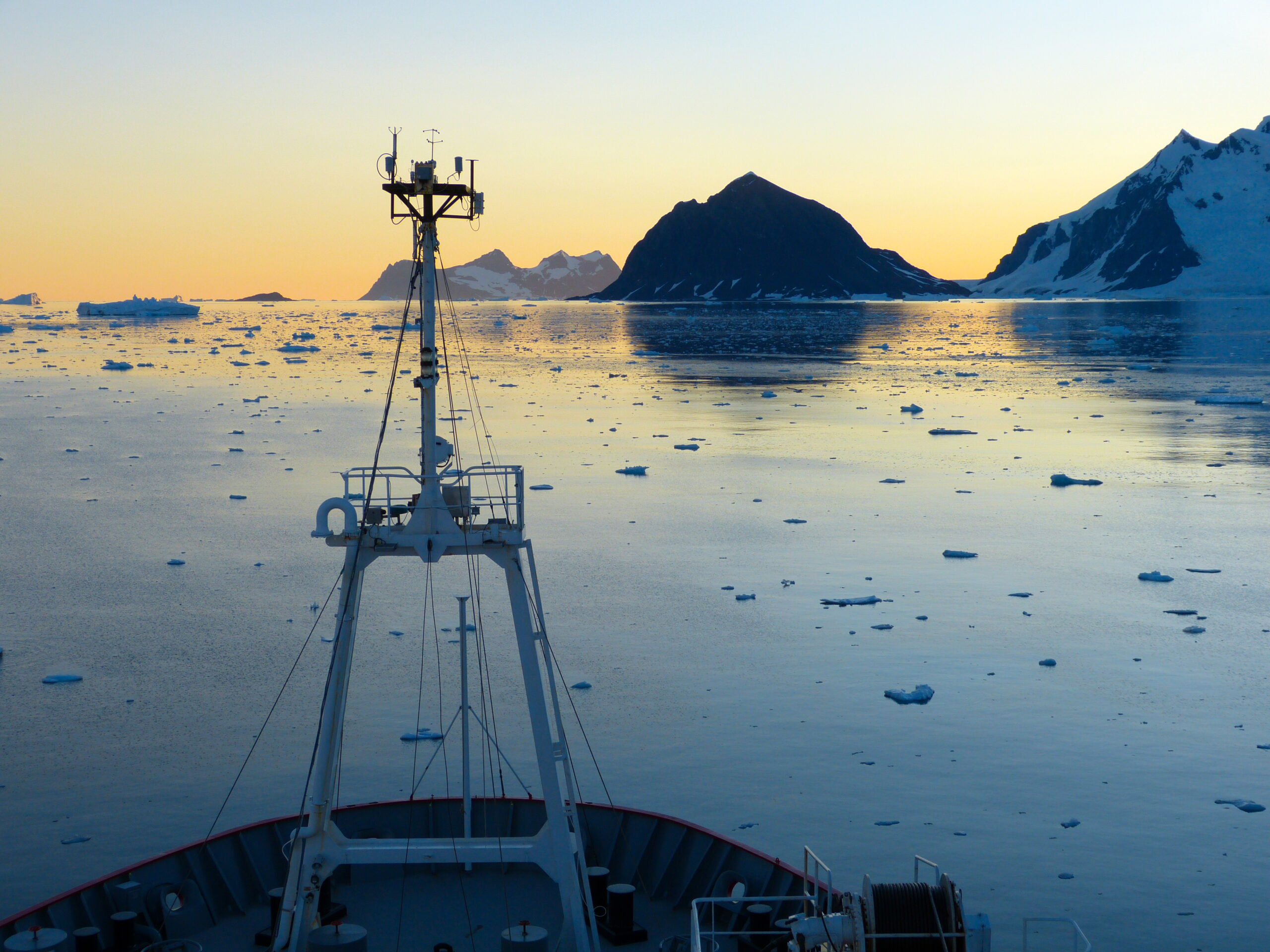
Winter in Antarctica is typically the preserve of the few hardy souls who “winter over” at the research stations scattered across the icy continent. But this year, I’ve had the extraordinary privilege of spending time in the Southern Ocean aboard the RRS Sir David Attenborough during the Antarctic winter – a rare opportunity that has yielded some fascinating scientific insights.
Antarctica may seem remote, but its influence stretches across our entire planet. The melt from its vast ice sheet contributes to rising sea levels globally. Changes in ocean circulation and sea ice affect climate patterns worldwide. Even shifts in the Southern Ocean’s chemistry and biology ripple through ecosystems thousands of miles away. While we’ve established these connections scientifically, we still need to understand the detailed mechanisms controlling these processes and how they might change in future. This knowledge is crucial if we’re to take meaningful action now to minimise negative impacts and prepare for inevitable changes.
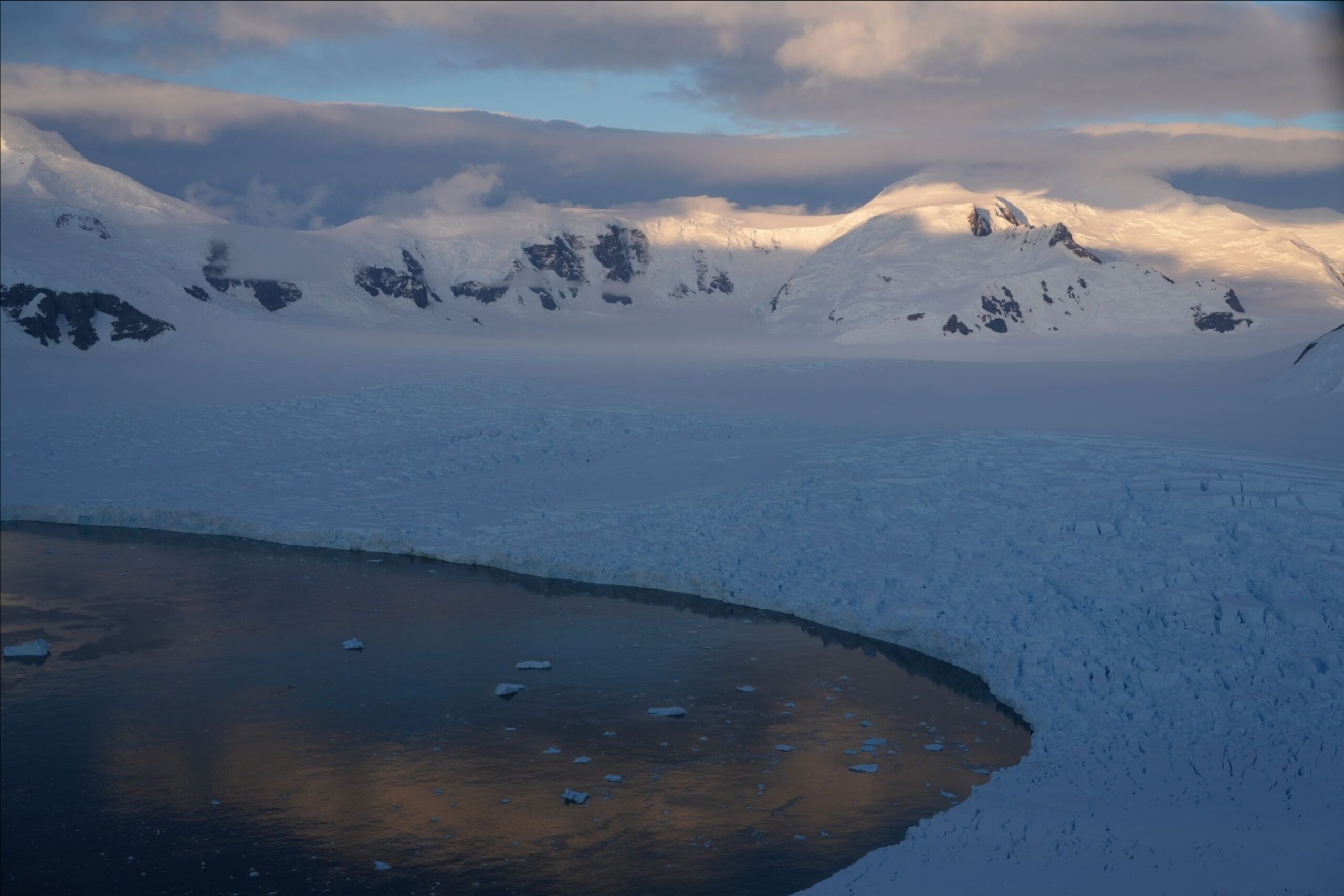
Surveying the edge of the William Glacier in Börgen Bay, Antarctic Peninsula. Photo credit: Mike Meredith.
Most Antarctic expeditions happen during the austral summer when conditions are relatively forgiving – warmer temperatures, minimal sea ice, and those famous endless daylight hours. But some critical processes function very differently during winter months. Glacier melting patterns change, nutrient delivery to the ocean shifts, and the growth of plankton – the foundation of the marine food web – follows different rhythms. Gathering winter data is challenging when you’re facing hostile weather, extensive sea ice, and perpetual darkness, which makes our expedition particularly valuable.
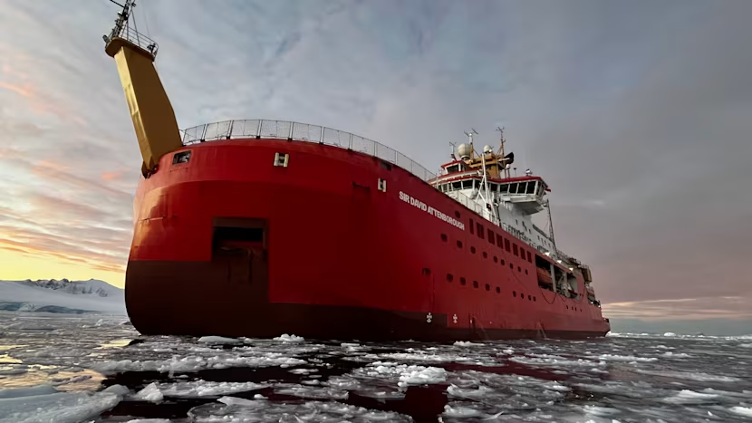
RRS Sir David Attenborough in the Antarctic winter. Photo credit: Lewis Bumstead.
Even in these early stages of analysis, our winter expedition has revealed some intriguing findings. We’ve mapped the seabed near important glacial systems with greater precision, improved our understanding of how ocean processes drive wintertime glacier melting, and begun exploring how these glacial systems might actually help fuel marine life. There’s still extensive work ahead to fully analyse everything we’ve collected, but the value of conducting these rare winter expeditions is already crystal clear.
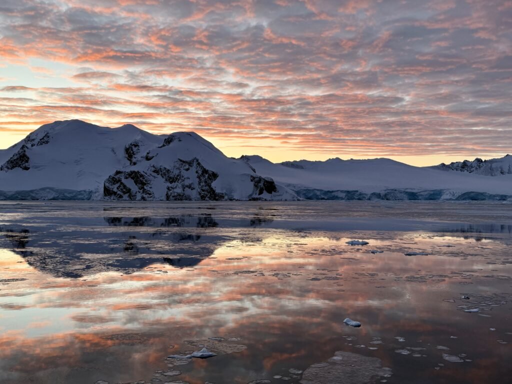
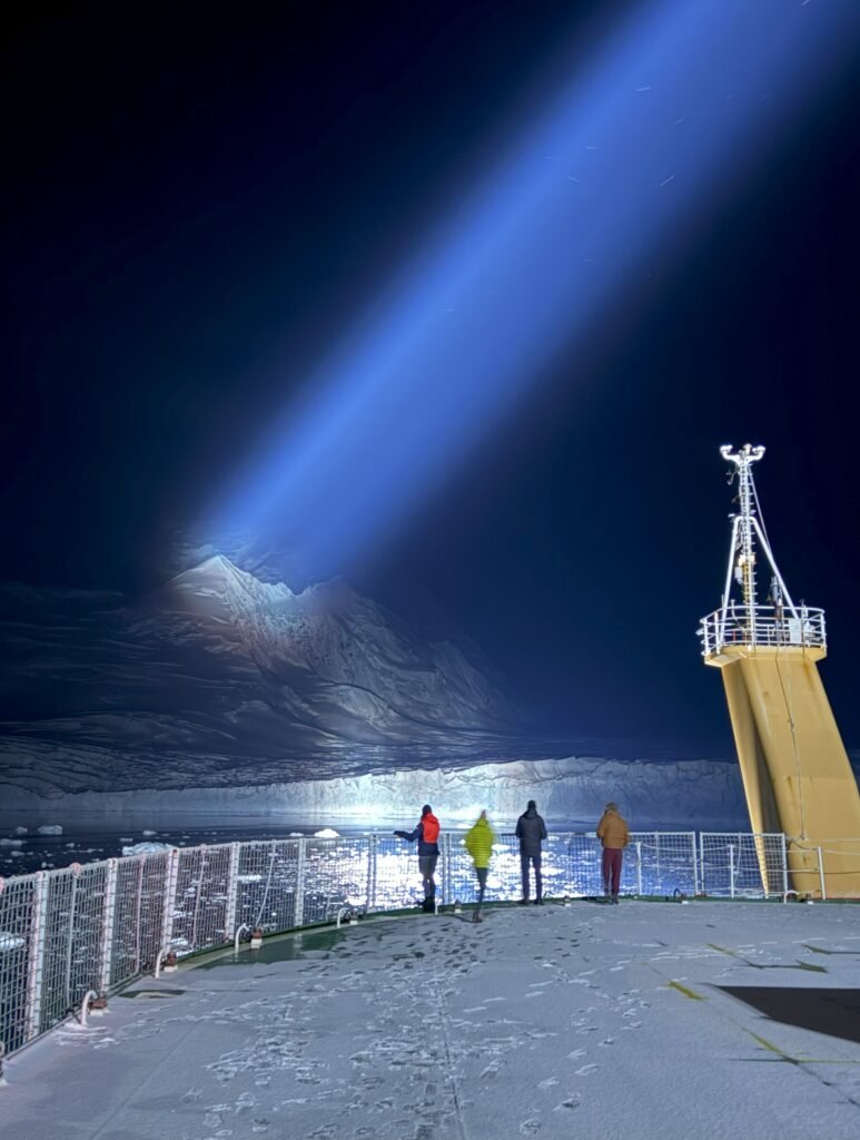
Hostile conditions in winter include perpetual darkness, sea ice, icebergs and blizzards. Sometimes we encountered all at once. Photo credit: Mike Meredith
Beyond the science, being here has been an extraordinary personal experience. The brief winter days create extended twilight periods where sunrise and sunset blend together, painting the ice and ocean in spectacular colours. On clear nights, the dark skies reveal stunning views of stars and the Milky Way, unimpeded by light pollution. We’ve witnessed glaciers calving icebergs right before our eyes – a powerful reminder of the dynamic nature of this seemingly frozen landscape.
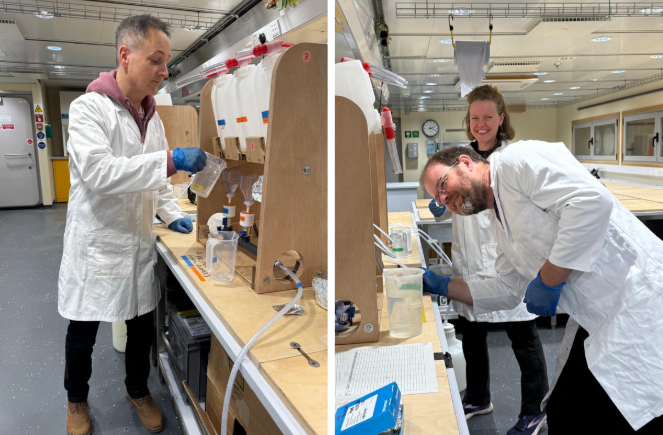
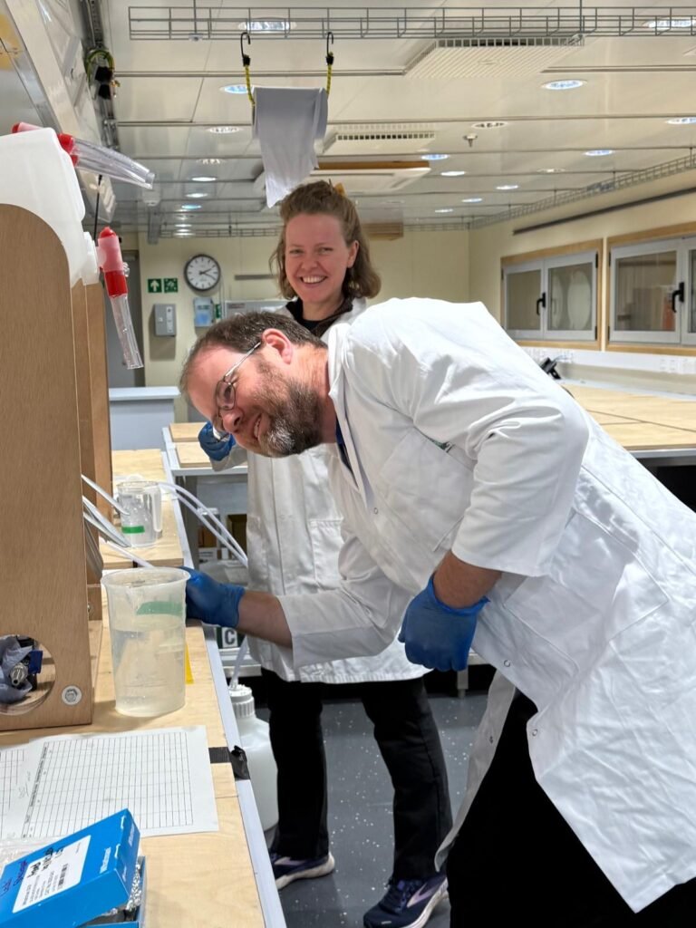
Mike, Hugh and Rhiannon at work in the labs on board the RRS Sir David Attenborough. Photo credit: BAS
I was surprised by how much wildlife we encountered, possibly due to this winter’s unusually light sea ice cover. During just one day of our southbound journey, we spotted over a hundred humpback whales. We’ve also had frequent visits from inquisitive seals, coming to investigate our scientific equipment in the water. Their company was particularly welcome during the long, dark winter nights!
New Bransfield House at Rothera Research Station. Photo credit: BAS
This winter research expedition to Antarctica has been both scientifically valuable and personally transformative. We’re returning home not just with new scientific knowledge, but with a deeper appreciation for this remarkable place – a frozen wilderness that, despite its remoteness, connects to all our lives through its profound influence on our shared planet.
The Scenery in which we’re working. Photo by Mike Meredith
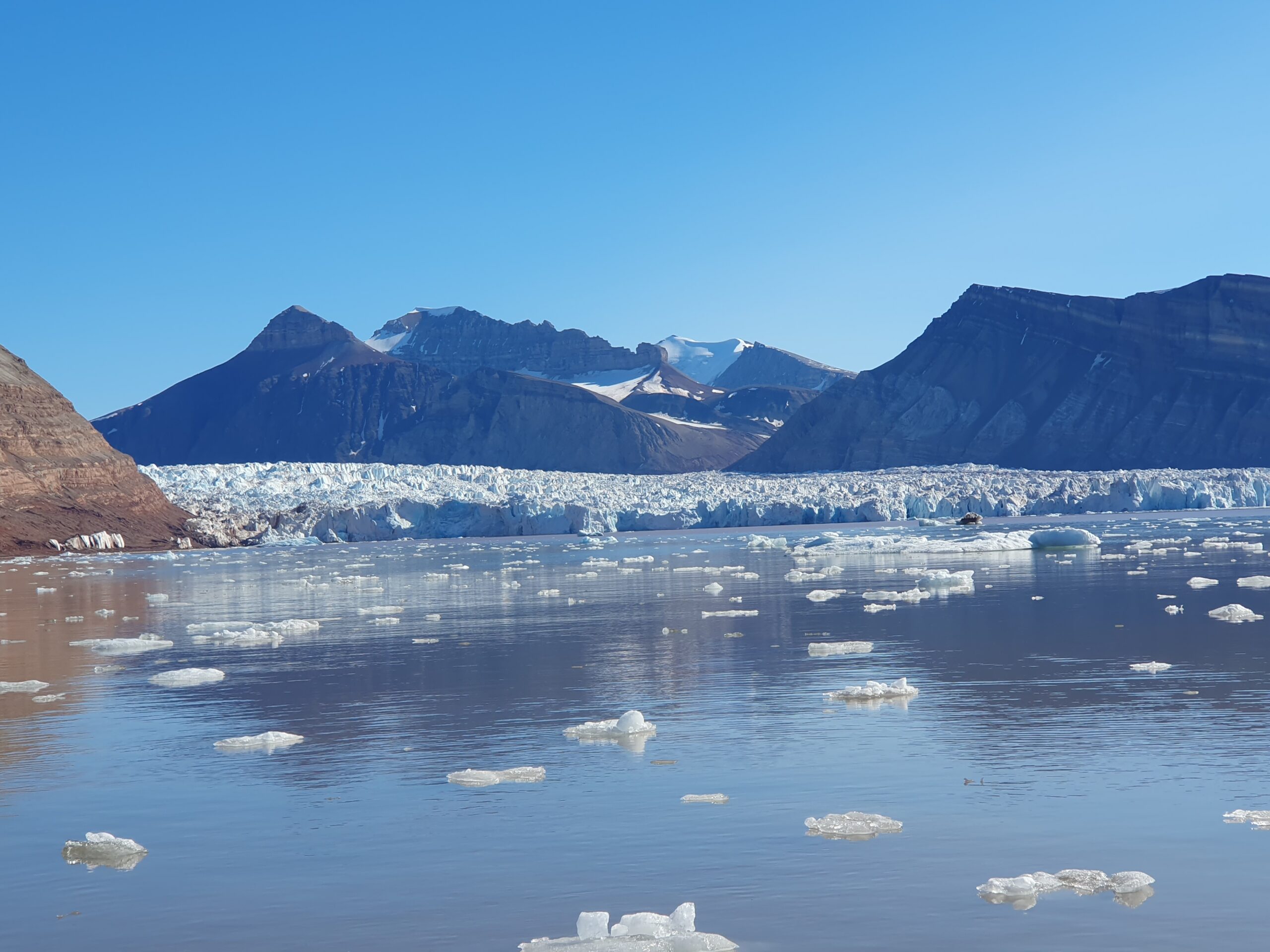
Science on the British Antarctic Survey’s research vessel RRS Sir David Attenborough cruise SD050 has now entered full swing, with sequences of oceanographic measurements close to the Sheldon Glacier near Rothera, near Blaiklock Island, and adjacent to the Horton and Hurley Glaciers. This cruise is a rare wintertime expedition with the ship, and affords us an excellent opportunity to further our understanding of how glaciers impact the ocean, and vice versa. It contributes to a number of scientific projects, including serving as a precursor the main POLOMINTS fieldwork that starts next season.
During our transit south to Rothera, we took the opportunity to make measurements in some important field sites along the way, including Börgen Bay on Anvers Island. This was the location where we witnessed a major glacier calving event some years ago, with bursts of rapid and intense ocean mixing as a result – the occurrence that led to the POLOMINTS project. We were surprised to again witness a calving event in Börgen Bay, albeit a smaller one, since such calvings are much more frequent in summer. We’ll be examining the data we collected there closely to look for the impacts on the ocean, and to better understand the seasonal differences in such effects.
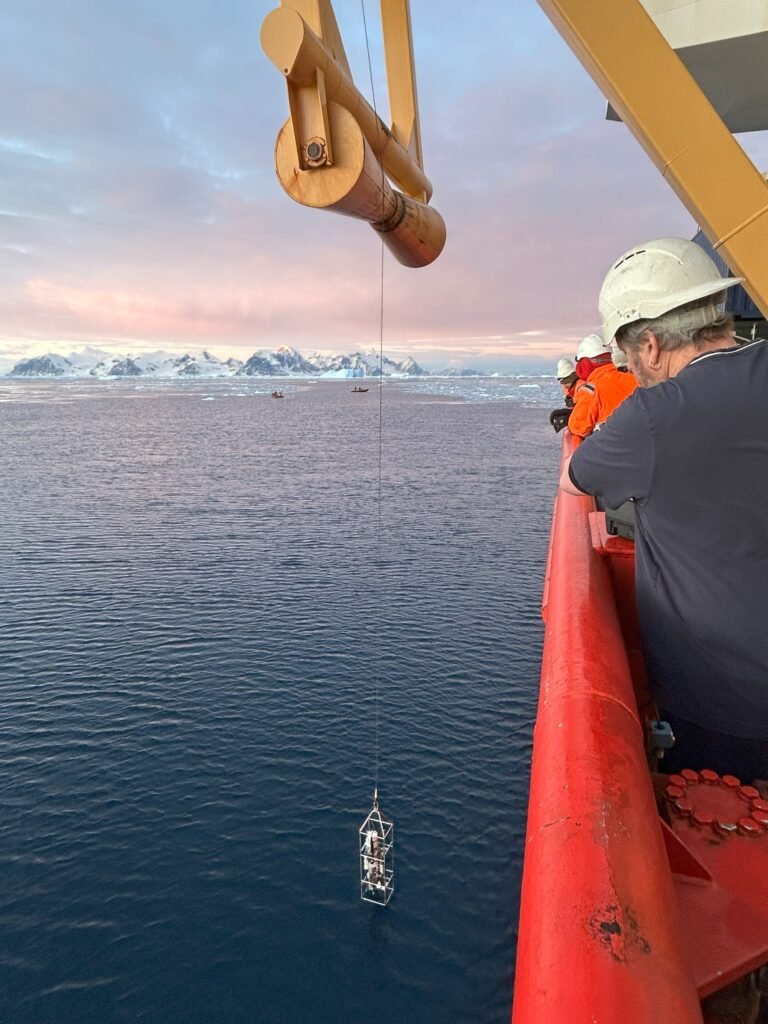
CDT Deployment. Photo by Mike Meredith
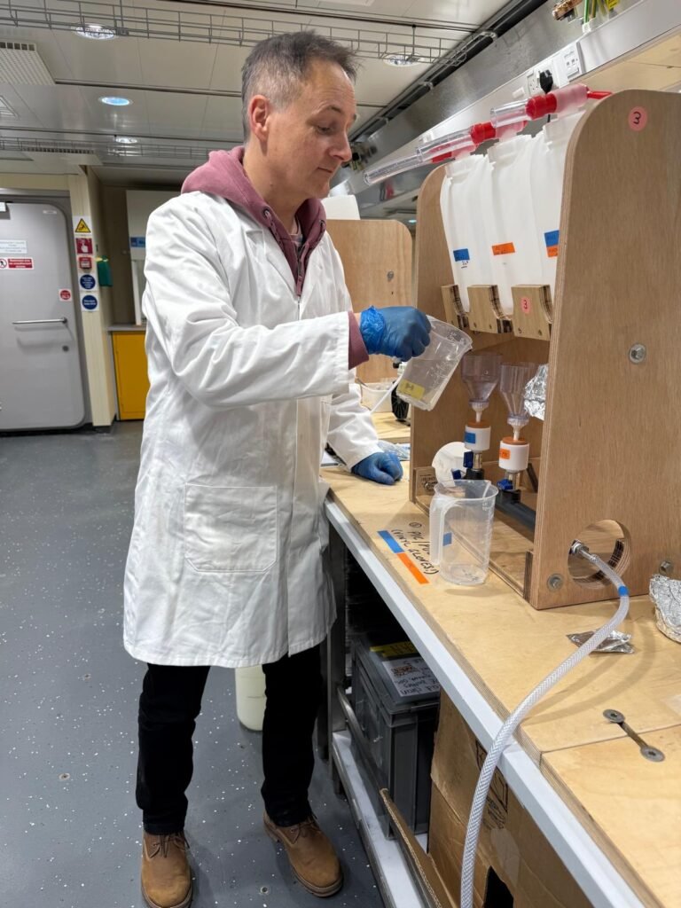
One of the main instruments we are using on this cruise is a Conductivity-Temperature-Depth (CTD) system, which is lowered from the ship to near the seabed, and which provides us with vertical profiles of key ocean variables that we’re interested in: temperature, salinity, chlorophyll concentration, and so on. We’re also collecting water samples for analysis in the ship’s laboratories, with some being saved for analysis back in the UK, and additionally will be collecting sediment samples. Taken together, these data and samples will help progress our understanding of how glacier melt and calving affects the ocean, and how nutrients fuel the growth of life in the sea. Ultimately, the science will contribute to our understanding of how the ocean around Antarctica impacts climate and the ecosystem, with the wintertime nature of these data will making them especially valuable.
We are most grateful to the outstanding work of the officers and crew of RRS Sir David Attenborough for supporting this science !
Cruise SD050 includes some pre-cursor science to the major POLOMINTS field programme that starts in January 2026. ITV News are reporting from SD050, including with POLOMINTS scientists.
RRS Sir David Attenborough winter cruise SD050 is currently on transit south toward Rothera and Ryder Bay, which will be our main POLOMINTS field site next summer season. During our transit, we called into Börgen Bay on Anvers Island, to take advantage of the opportunity to collect some water samples and underway ocean measurements. This is an especially interesting location for us, being where we witnessed the major glacier calving event some years ago that led to our discovery of calving-induced internal tsunamis, and the POLOMINTS project overall.
We studied the glacier in Börgen Bay for several hours while collecting measurements, during which we witnessed a significant calving event. This was surprising and fortuitous, since glacier calving is typically much more frequent in summer. We continue to learn and build up our understanding of these important dramatic events!
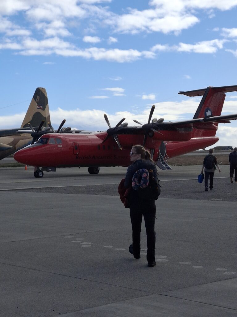
In the early morning of December 20th Kate Hendry (BAS) and Alanna Grant (CEH) boarded the British Antarctic Survey’s Dash 7 airplane at Punta Arenas airport to make the five-hour journey across the Drake Passage to the West Antarctic Peninsula. They were making their way to Rothera Research Station for the BIOPOLE project.
Alanna and the Dash 7 airplane at Punta Arenas airport (credit: K Hendry)
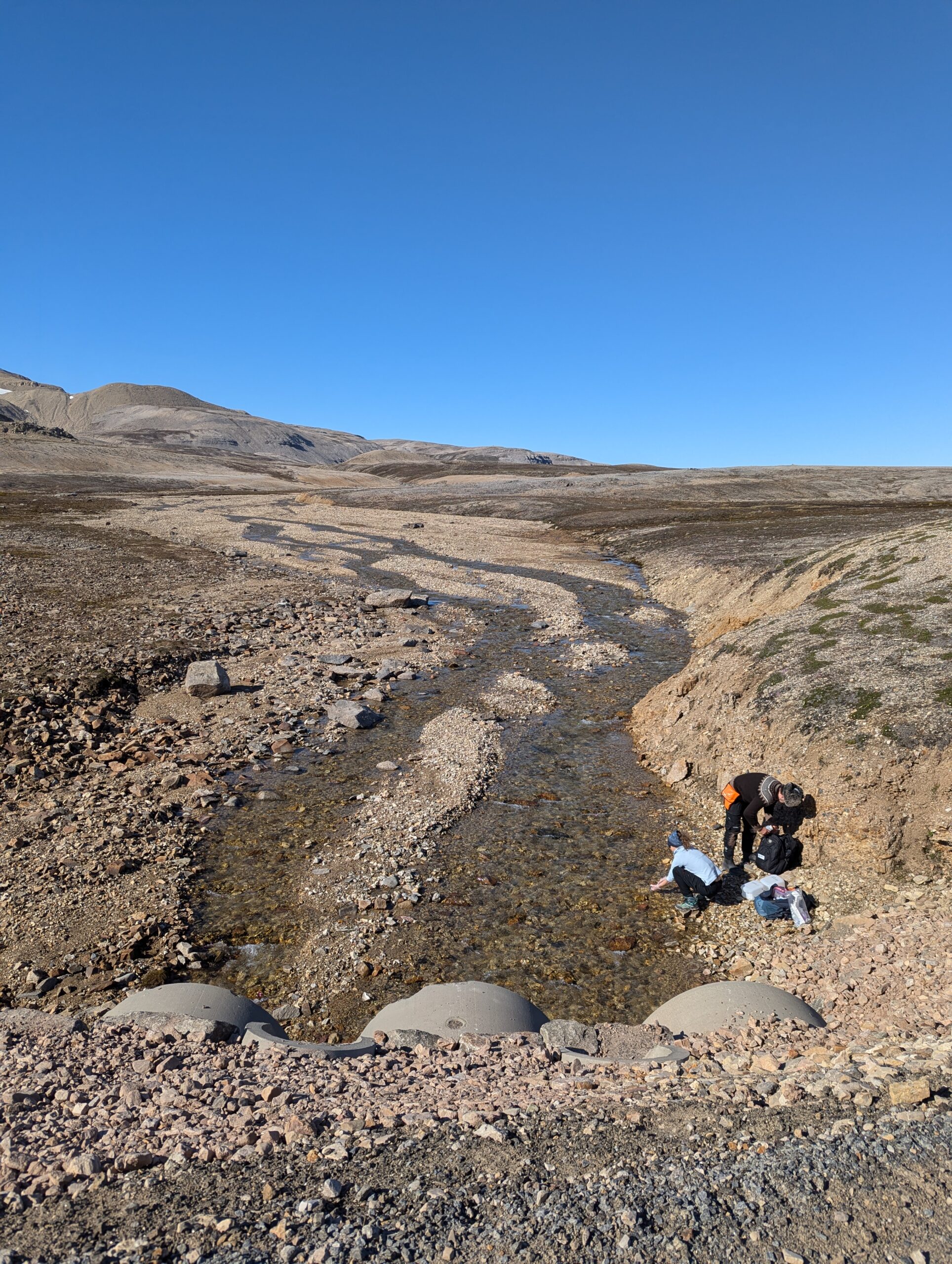
The overall aim of the BIOPOLE Rothera campaign was to assess the flux of organic and inorganic nutrients into Ryder Bay, the glaciated bay near Rothera Research Station. Kate and Alanna worked together in 2023 during the first BIOPOLE Svalbard fieldwork season, but faced very different conditions this time around off the West Antarctic Peninsula.
Whilst the northern fieldwork involved extensive river sampling, of glaciated and non-glacial river systems, the freshwater inputs into Ryder Bay are much harder to access. They’re hoping to be able to sample surface meltwater runoff later in the season, as the summer months progress, but in the meantime will be sampling seawater and using isotope geochemistry to unpick the meltwater contributions.
Alanna in front of the RRS Sir David Attenborough in Ryder Bay (credit: K Hendry)
As well as characterising freshwater inputs, the team have been working with the Rothera Time Series (RaTS) project, together with Rothera Ocean Scientists Alice Clement and Sean McLoughlin, to sample marine waters within Ryder Bay. RaTS has been operating since 1997, and is an almost unique long-term observational dataset, especially important as data are collected year-round (not just in the Antarctic summer, when access is more straightforward).
The BIOPOLE fieldwork is being carried out in collaboration with NERC-funded project SiCLING. Kate will be joined by SiCLING team members later in January to carry out sampling of marine sediments and waters.
The BIOPOLE/SiCLING team would like to thank Allie and Sean (Rothera Ocean Scientists), and the rest of the marine team. Thanks also to everyone at Rothera Research Station for all their support.
You might imagine glaciers as vast, cold, and lifeless rivers of ice, but they’re far more dynamic and alive than we once thought. Kate Hendry, polar oceanographer at British Antarctic Survey is currently working in the Arctic. Below, she shares some insights from her recent research on these frozen rivers, and their impact on our oceans.
The team are in the Arctic studying glaciers and their impact on our oceans. Kate Hendry.
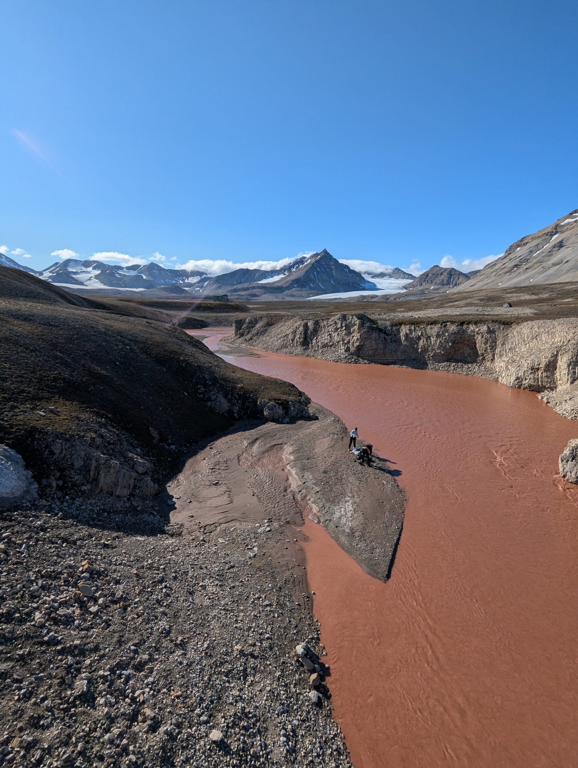
Glaciers – vast rivers of ice that flow from ice caps and ice sheets – were once thought to be inert environments, too cold for biology or for chemical reactions to occur. In the past two decades, scientists have discovered that glaciers are teeming with diverse microorganisms and are hotspots for biogeochemical weathering—chemical processes that release essential elements into the environment. As glaciers flow, they grind the underlying rock into a fine “flour,” and the unique chemistry of the waters beneath these ice sheets leads to the formation of new, highly reactive materials. This glacial flour can release nutrients into the environment, acting as a significant source of precious elements for coastal marine ecosystems. While glacial flour has the potential to fertilize crops, it can also harbour toxic metals. We are just beginning to unravel the intricate web of interactions among these elements as they travel downstream.
As glaciers flown they grind the underlying rock into a fine “flour” which releases nutrients into the environment. Kate Hendry.
Unveiling the role of silicon
One key nutrient we’re focusing on in our new project, Silicon Cycling in Glaciated Environments (SiCLING), is silicon. Every living organism needs silicon in small amounts, but some, like plants and diatoms (a type of algae), need larger quantities to build their silica-based structures. Glacial flour is rich in reactive detritus that dissolves, releasing biologically available silicon. This means it could be a vital nutrient source for crops and coastal marine systems deficient in silicon.
Through SiCLING, we’re investigating how silicon in glacial flour and fjord sediments is released, interacts with other elements like iron, and changes with global warming and accelerated ice melting.
Our journey begins in Ny-Ålesund, northern Svalbard, in the land of the polar bear. Here, we’re sampling water, flour, and sediments from Kongsfjorden near the UK Arctic Research Station. Using small boats, we collect samples and process them in the station’s labs. Many analyses will be done back in the UK, where we’ll use cutting-edge imaging and geochemical fingerprinting to understand silicon’s interactions with other elements. With all the data we gather, we’ll use new modeling methods to calculate how much silicon glaciers in Svalbard release.
Later this year, we will continue our fieldwork adventure by comparing our Arctic findings to coastal environments off the West Antarctic Peninsula.
Through the SiCLING project, researchers are looking at how silicon in glacial flour is released. Kate Hendry.
Meet the team
I am proud to lead the SiCLING project as the Deputy Science Leader of the Polar Oceans Team at the British Antarctic Survey. Joining me in Ny-Ålesund are Nathan Callaghan from the UK Centre for Ecology and Hydrology and Katie Howe from Dauphin Island Sea Lab, USA. Nathan is working on river chemistry and fluxes, and Katie is joining us as an expert in isotope uptake experiments. Our team also includes Rhiannon Jones and Siobhán Foden from BAS, and Helen Williams, and Helena Pryer from the University of Cambridge.
We’re thrilled to share our progress with you as we delve deeper into the fascinating world of glacial biogeochemistry. If you’re curious to learn more about our findings on silicon and glaciers, check out our latest paper: Detrital input sustains diatom production off a glaciated Arctic coast.
Glaciers are teeming with diverse microorganisms and are hotspots for biogeochemical weathering. Kate Hendry.